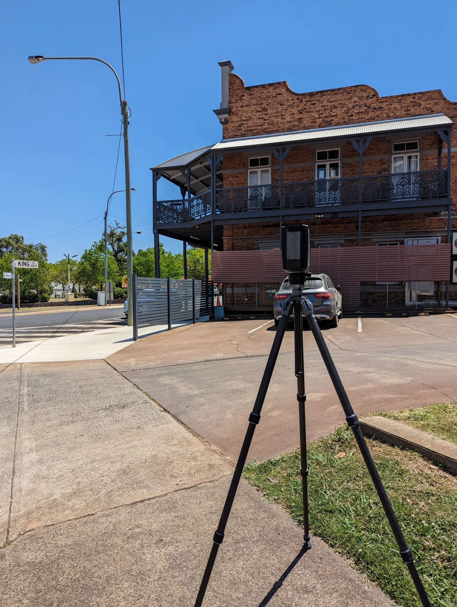
Surveying, as every other industry, is evolving. Traditional surveys gathering individual observations to create simple plans and models, whilst still relevant, struggle to capture the increasingly dense and complicated world we live in. 3D laser scanning now allows surveyors to rapidly capture vast amounts of millimetre accurate measurements. These measurements are remotely captured from multiple setups throughout a site to afford comprehensive point cloud capture. Given the ability to remotely measure structures, features and environs, 3D laser scanning is a substantially beneficial technology to rapidly capture, dense and accurate surveying information in dangerous or complicated environments or detailed information of objects and items.
How does it capture that level of detail?
Much like a camera captures 1000’s of pixels which create a photograph, a 3D laser scanner captures millions of laser measurements which create a 3D point cloud representing the world around us. The scanning unit has a mirror which spins at high speed vertically whilst the entire unit rotates around 360 degrees horizontally, allowing capture in a dome surrounding the scanner. The laser bounces off of interacting objects accurately measuring position and distance, in turn creating the representative “point cloud” of the environ or object.
This point cloud can then be interpreted by surveyors, architects and engineers to create working 3D models and accurate point and line strings representative of site layout and shape.
The density of the captured point clouds also allows structures, features and environs to be interrogated in great detail; further informing design options, providing greater clarity of existing site conditions or additional detail for monitoring.
Data can be provided in point cloud format for point cloud savvy stakeholders or further enhanced and manipulated into 2D/3D points and strings or processed further still into 3D models and Building Information Models (BIMs).
Leading Surveys can ensure that the point cloud information provided reflects the real world by utilising surveying and scanning technology hand-in-hand.
The best situations to use 3D scanning on:
- Heritage/Historical/Artistic
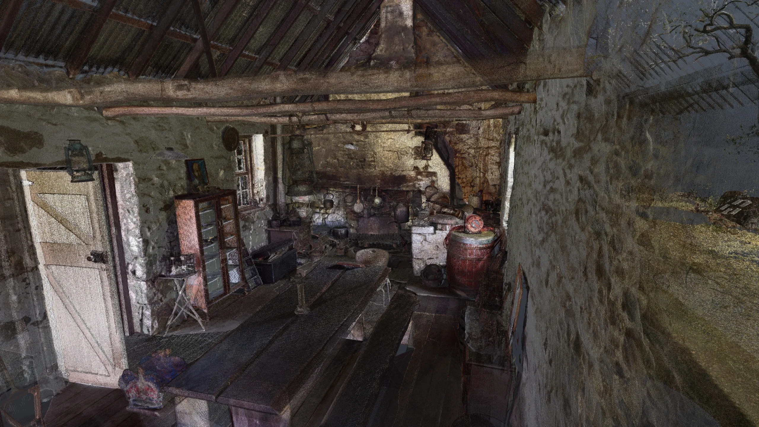
- Capture accurate data to understand how something was constructed – perfect for restoration, archival and preservation.
- Perfect for capturing the layout and “state” of a site at a point in time, especially relevant for theatre productions, archaeological digs, built heritage, cultural heritage and forensics.
- Able to remotely and accurately measure sensitive sites where hands on measurements or “boots on the ground” could damage the object or site.
- Environmental change recording, reporting and documentation.
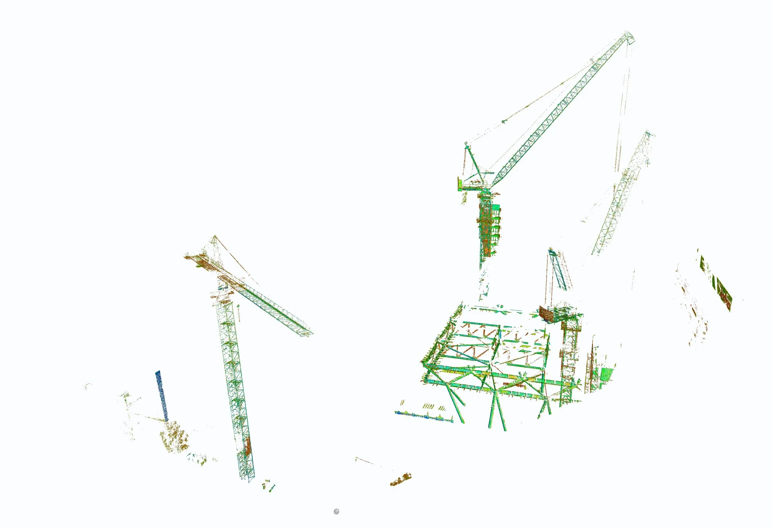
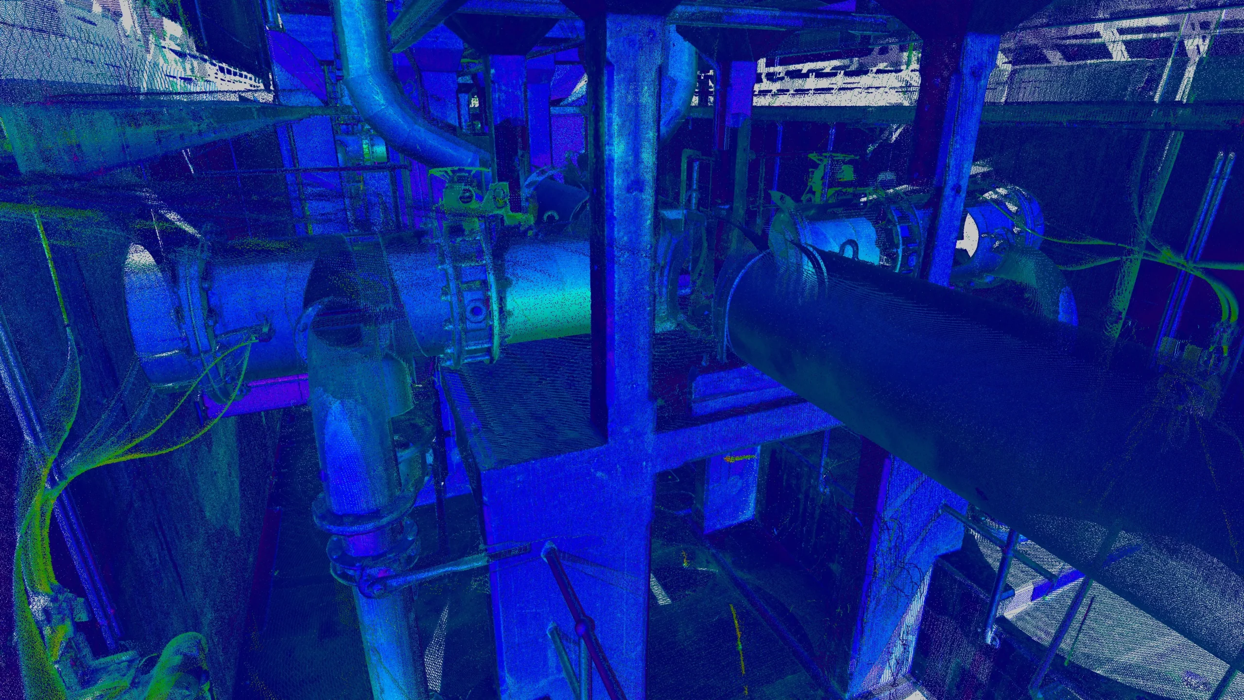
- Architectural & Engineering
- Design overlay
- As-built documentation
- Clash detection
- Flatness or verticality reporting
- 3D Modelling
- Inspections – As constructed, maintenance & asset management
- Monitoring
- Remote stockpile and volume measuring
- Reverse engineering
- Building Information Modelling (BIM)
- Remote measurement of dangerous environments (confined spaces, rail corridors, roadways, ship strapping)
What files can I expect? I don’t have software to run models.
- File formats compatible with architectural and engineering packages are readily exported and able to be provided.
- Free viewers with Google Streetview style viewing also allowing basic measurement and interrogation are able to be provided.
Cost expectations – bang for buck
Cost is entirely dependent on detail required and the extent of the subject area, laser scanning is a guaranteed way of capturing highly dense information in a very short period of time when compared to traditional surveying methodologies. It can entirely negate the need for revisits as the entirety of a site can be measured in one visit.
Time allowances on site?
Much like costing, the time required is solely dependent on the scope.