A boundary survey is a small upfront cost and can legally safeguard you and your Queensland property. By clearly defining where your property begins and ends, including easements or leases, and opportunities to subdivide, you will be armed with assurance and information needed to advance in your largest investments.
Conducted by an appropriately qualified surveyor registered with the Surveyors Board of Queensland, a range of legal and physical features are considered (including deed delineation, official records and historical survey marks) to provide true and accurate determination of boundary position. Highlighting encumbrances, easements, encroachments & zoning issues prior to construction of dividing fences & walls, significant renovations and subdivisions or to ascertain the true boundary position relative to existing site features and structures.
Common Misconceptions
Isn’t checking the boundaries part of the conveyancing search?
No, the searches conducted by conveyancers are essential to attain information relating to legal and administrative burdens and encumbrances over a property; these may include local government and local authority searches, environmental searches, drainage and water searches, flood searches and most commonly registered owners, any encumbrances (including mortgages, caveats, covenants and infringement notices) and body corporate arrangements for community titled properties (ie. units, townhouses etc).
Aren’t the boundaries where the fences and walls are?
Not always, over decades fences and walls get rebuilt and don’t always go back in the same place and all of this assumes that the first fence was built in the correct position. This can be particularly noticeable in very old areas or areas of significant terrain changes such as hilly and creeks.
The current owners and the neighbours are happy with where the fences and structures are now, so why should I worry where the boundary truly is?
Neighbours change and what was once a mutual understanding can suddenly become a point of serious contention.
I have title insurance, so I do not have to worry.
Yes, title insurance may help cover the monetary costs of dealing with issues arising from incorrect or erroneous boundary definition (ie. encroachments out of or into your property), but it does not make the problem go away there is still the physical, mental and emotional tolls to consider. Furthermore, it does not highlight the boundary issues at the start of the process, nor does it guarantee the accuracy of the property boundaries.
Isn’t a boundary survey expensive?
A typical boundary survey is a minor expense when compared to the costs which could be incurred from legally and physically remedying an encroachment from your property onto a neighbours or value lost due to an encroachment from a neighbour’s property onto yours. This could include removal of built structures which are too close or over a boundary and administrative and legal costs to meet a resolution. In addition, delays to construction, sale or development can come with significant “holding” costs which an early boundary survey could have allowed expeditious resolution or negated entirely.
I checked the boundaries online and with my handheld GPS.
Handheld GPS and online maps are great tools to navigate around and get a basic understanding of site layouts and positioning; however, the accuracy of these tools varies greatly and cannot provide a legal boundary definition.
My property is only small, aren’t boundary surveys just for large properties?
As land values surge and average land sizes are reduced even small discrepancies can be incredibly costly, especially as offsets from dwelling to dwelling and dwelling to property boundary become tighter.
My property is a unit or town house or commercial property in a mixed-use building, so I do not have to worry about boundary determination.
Whilst there can be more clarity and certainty in situations where boundaries are determined by structures, such as leases, building format plans and community title schemes; discrepancies can be created as building uses and layouts can change which impact the determination of these boundary positions. Especially common in lease and exclusive use areas, volumetric boundary and building format plans can all suffer similar impacts to boundary determination.
What is a Boundary Survey Exactly?
A property boundary can be defined as the delineation of a right or interest in land and can be the property boundary between properties, the boundary of a lease of land, the boundary of a secondary interest (easement, covenant or profit ? prendre), the term cadastral boundary is also interchangeable with survey boundary and property boundary, likewise cadastral survey, boundary survey and property line survey.
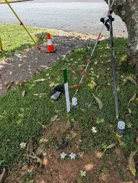
A boundary survey is conducted to determine the true location and delineation of property boundaries, leases and secondary interests (easements, covenants or profits ? prendre) and nearby features and structures and are called cadastral surveys. These boundaries are defined by survey marks, typically white pegs placed at boundary corners and cannot be determined by GPS coordinates or online tools. A cadastral survey to determine existing boundary and/or secondary interest locations and position of nearby features and structures is called a Boundary Identification Survey. A subdivision of land or creation of secondary interests can be undertaken by several different types of plans depending on the type of subdivision proposed, a traditional subdivision of land or creation of some secondary interests is classified as a standard Survey Plan, whilst creation of a complicated or mixed use development may require a Volumetric Survey, Building Format Plan and/or Exclusive Use plans, some leases are also created on simpler Lease Plans.
An appropriately qualified and registered surveyor will order all historical records showing legal and physical definition of the boundaries in question, consideration shall be given to all of this information in addition to conducting field measurements to monuments and features which determine a fair and legal reinstatement of the boundaries. A plan of survey must then be prepared and lodged with the Queensland Government as an official record of survey adding to the historical records available for future boundary determination.
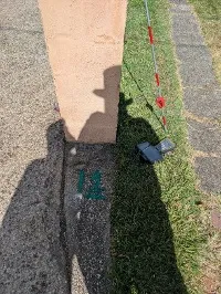
During the course of the field survey, the surveyor may utilise a variety of tools and instruments to conduct the works including, total stations, survey grade GPS, drones and laser scanners to collect accurate measurements. This may also involve needing to access the subject and adjoining properties to ensure that fair, legal and equitable land interests are maintained. Surveyors conducting boundary surveying works are permitted to enter property to conduct surveying works after reasonable attempts to notify the occupier have been made, this is why it is always a good idea to let your neighbours know that a boundary survey is being conducted.
Whilst not legally required, many banking institutions and title insurers may require a boundary identification survey to be conducted prior to lending or providing insurance; many building certifiers, builders, fencers and other contractors may also require a boundary identification survey be conducted to facilitate construction of new structures or remediation to existing structures and provide certification. Local governments will also require boundary surveys to be conducted as part of a subdivision of land, as part of a building permit approval, zoning changes or relaxation applications.
Links & Resources
Queensland Government – Survey marks and property boundaries
https://www.business.qld.gov.au/industries/building-property-development/surveying/permanent-marks
Surveyors Board of Queensland – GUIDELINE – SURVEYS RELATING TO PROPERTY BOUNDARIES
http://sbq.com.au/wp-content/uploads/2022/06/Guidelines-in-Boundary-Surveys.pdf